 EMODnet Product Catalogue
/Physical Environment/Bathymetry/Digital Terrain Model
Type of resources
Available actions
Topics
Keywords
Contact for the resource
Provided by
Years
Formats
Representation types
Scale 1:
Resolution
-
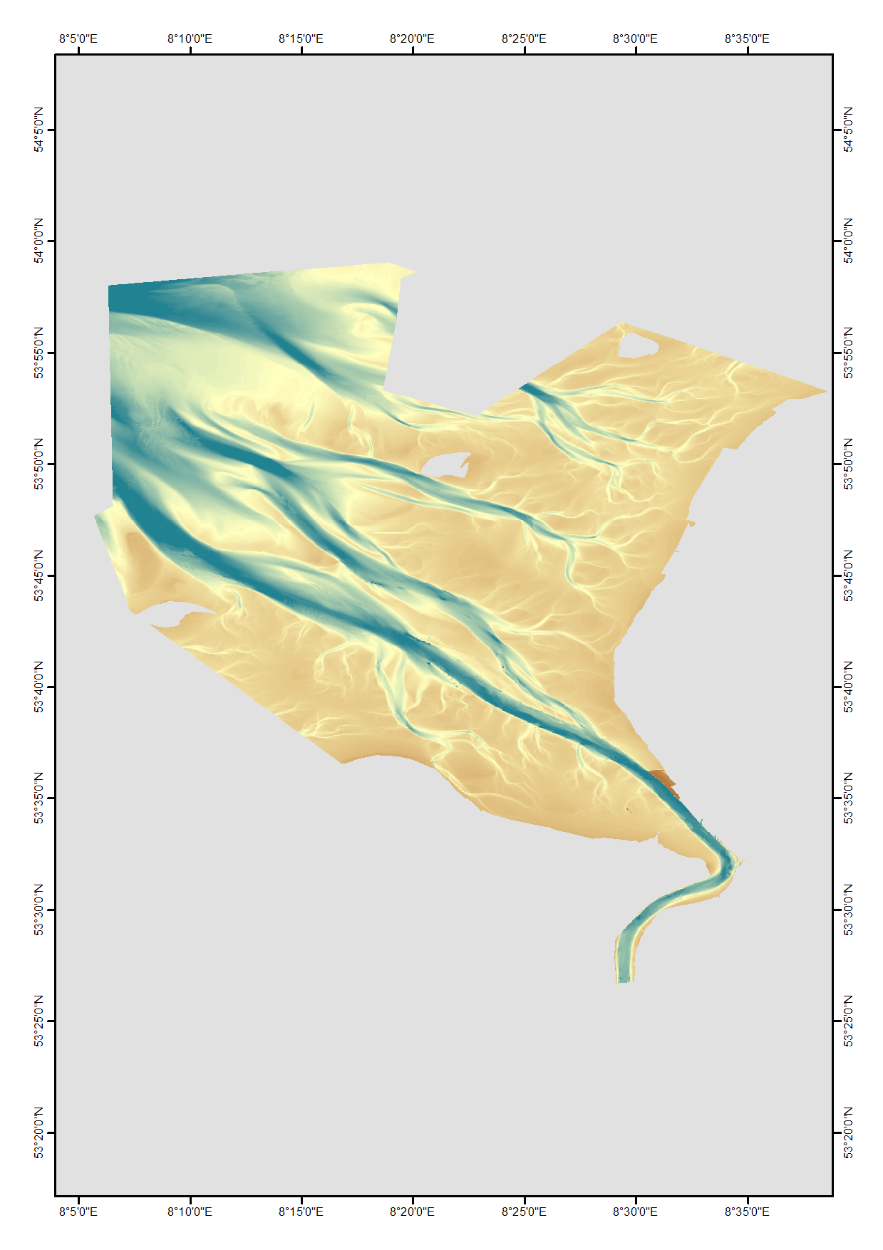
High resolution composite DTM based on single beam, multi beam and Lidar covering the Weser and Weser approach. All data acquired in the years 2010-2017.
-
Bathymetric data resulting from hydrographic surveys for cartographic purposes and/or port management. Surveys carried out in accordance with the IHO S-44 standard.
-
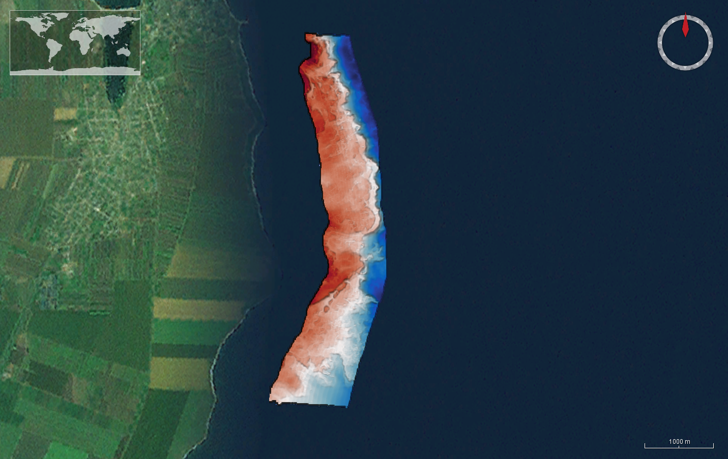
The DTM is produced with Kongsberg multibeam echosounder survey, acquired in March 2020 by Marine Research Ltd. The resolution is 1/256 arc-minutes (~7.2m). It is located at Tuzla, Romania, on the coastal region of the Black Sea. Depths are referenced to the Local Sea Level - Marea Neagra 1975 and the coordinates are expressed into the WGS84 reference frame.
-
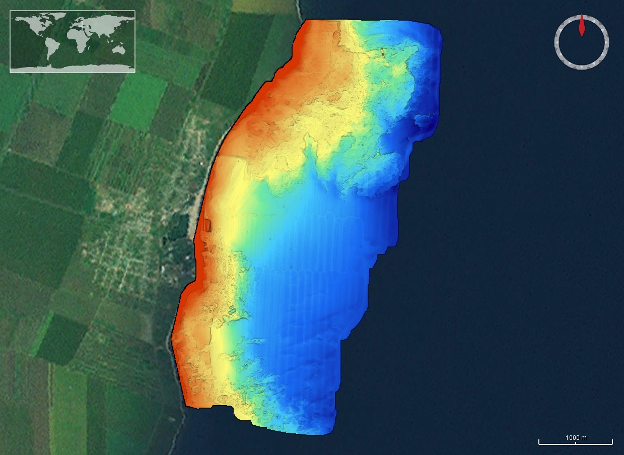
The DTM is produced with Kongsberg multibeam echosounder survey, acquired in 2015 by Marine Research Ltd. The resolution is 1/256 arc-minutes (~7.2m). It is located in Costinesti, Romania, on the coastal region of the Black Sea. Depths are referenced to the Mean Sea Level and the coordinates are expressed into the WGS84 reference frame.
-
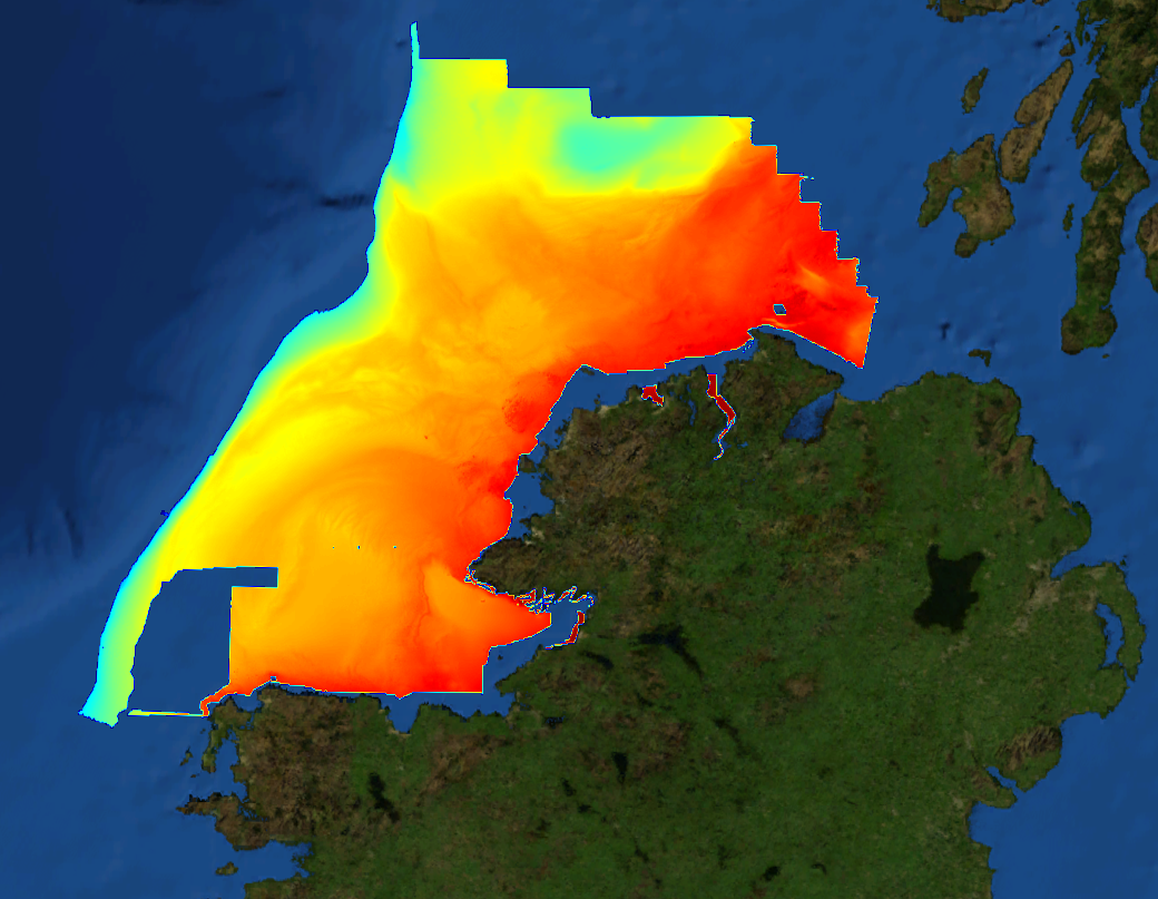
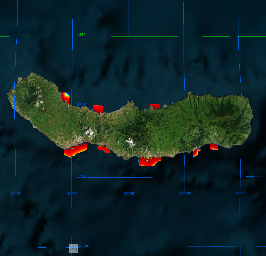
This composite Digital Terrain Model (cDTM) is a high resolution bathymetry dataset highlighting measurement of depth of water in the ocean. This cDTM covers the North Atlantic Ocean off the coast of County Donegal in Ireland. The EMODnet high resolution DTM covers bathymetry surveys completed between 2002 and 2016. Bathymetric data collected on board research vessels using multi-beam and single-beam echosounder instrumentation. Raw bathymetry processed within CARIS software to produce bathymetry products subsequently converted to NetCDF cDTM for EMODnet. Acquisition, processing and product delivery follows IHO standard s44 Edition 5. cDTM is composed of eighteen (18) images “merged simply” using GLOBE software. INFOMAR (Integrated Mapping for the Sustainable Development of Ireland’s Marine Resource) is a twenty year programme to map the physical, chemical and biological features of Ireland’s seabed established in 2006. INFOMAR is funded by the Department of Communications, Climate Action and Environment (DCCAE), and delivered by joint management partners Geological Survey Ireland and the Marine Institute. The programme is the successor to the Irish National Seabed Survey (INSS) which ran between 1999 and 2005. INFOMAR concentrates on creating integrated mapping products related to the seabed.
-
The DTM is produced with Kongsberg multibeam echosounder survey, acquired in March 2020 by Marine Research Ltd. The resolution is 1/256 arc-minutes (~7.2m). It is located at 23 August, Romania, on the coastal region of the Black Sea. Depths are referenced to the Local Sea Level - Marea Neagra 1975 and the coordinates are expressed into the WGS84 reference frame.
-
The data were acquired with Reson SeaBat 7150 and 8111 multibeam echosounder systems on board the R/V OGS Explora in order to cover the Malta Escarpment for a geological survey in the framework of EU FP7 project SCARP.
-
The DTM is produced with Kongsberg multibeam echosounder survey, acquired in 2015 by Marine Research Ltd. The resolution is 1/256 arc-minutes (~7.2m). It is located south of Constanta Port, Romania, on the coastal region of the Black Sea. Depths are referenced to the Mean Sea Level and the coordinates are expressed into the WGS84 reference frame.
-
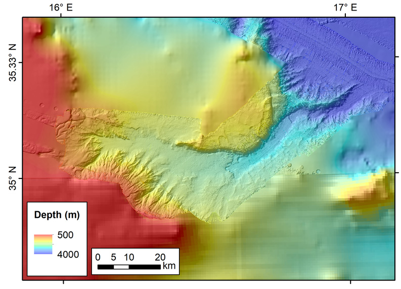
The data were acquired with Reson SeaBat 7150 and 8111 multibeam echosounder systems on board the R/V OGS Explora in order to cover the Malta Escarpment for a geological survey in the framework of EU FP7 project SCARP.
-
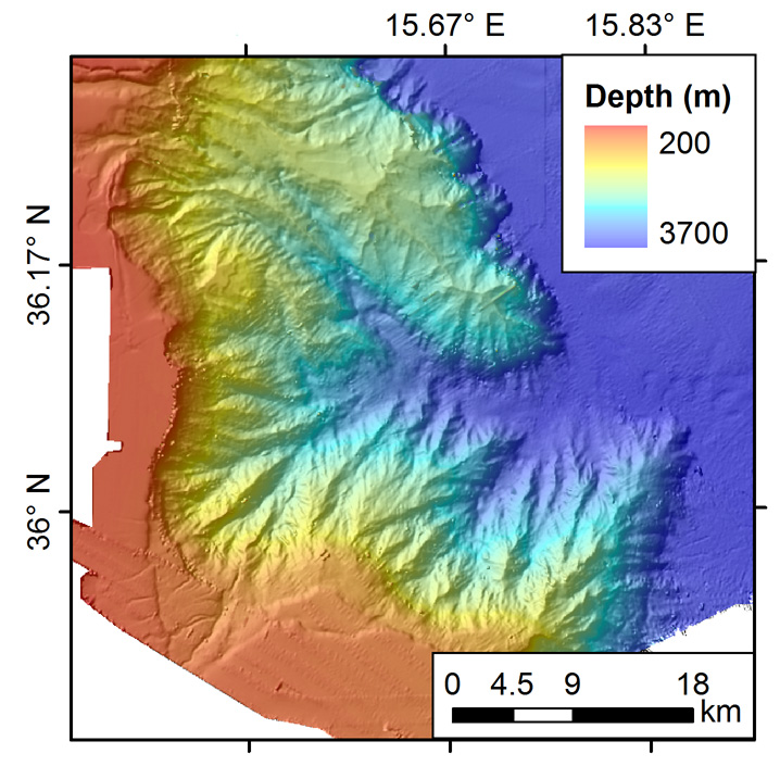
The data were acquired with Reson SeaBat 7150 and 8111 multibeam echosounder systems on board the R/V OGS Explora in order to cover the Malta Escarpment for a geological survey in the framework of EU FP7 project SCARP.